


WorldCereal is funded by the European Space Agency (ESA) and aims to develop an efficient, agile and robust EO based system for timely global crop monitoring at field scale.
 © WorldCereal project
The OpenSource WorldCereal system will be able to 1) Create local to global annual cropland extent maps at 10 m resolution, 2) Update the crop maps on a seasonal basis, 3) Differentiate between actively irrigated and rainfed fields, 4) Produce global maps of maize and wheat.
WorldCereal is a global R&D challenge aiming to engage the global agricultural community to achieve optimal results. The system is built upon existing initiatives on e.g in situ data collection and sharing, algorithm development, IT infrastructures and best practices.
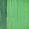
WorldCereal relies heavily on the operational time series of the Copernicus Sentinels missions, which allow an unprecedented dynamic crop monitoring at global scale.
By focusing on maize and wheat during the system demonstration, WorldCereal aims to contribute to the global food security challenge as together with rice, these crops form the world’s most widely cultivated species, accounting for an estimated 42.5 percent of the world’s food calorie supply (FAO).
IIASA actively provides reference data and builds the infrastructure for the reference data module. IIASA also will use the Geo-Wiki tools to do an internal validation of the products (maps) from the WorldCereal.
The project will consist out of two major phases; Phase 1 is dedicated toward the development of the system, benchmarking of the algorithms, setting up collaboration for in situ data collection, gathering data and data curation. The system will be tested for 5 countries on three different continents, covering about 1.5 million km².
Phase 2 is dedicated toward production of the global maps, evaluating the products on both accuracy and utility and showcasing the products.
Project Partners:
VITO Remote Sensing, ELEAF, CS, GISAT, University of Strasbourg, University of Valencia, Wageningen University and Research
News
15 January 2024
Satellite data for high resolution, seasonal, global-scale crop monitoring
The WorldCereal consortium recently embarked on a scientific journey to demonstrate the feasibility of global crop mapping at field scale to improve agricultural and water policies worldwide. Having made considerable achievements so far, the project is now entering a new phase.